Monday, September 5, 2016

Clayton Peak


Trailhead: Guardsman Pass, Big Cottonwood Canyon (elevation: 9,706 ft.)
Mileage (loop trail):  ~ 3.5 (my watch got stopped at some point)
Elevation @ Summit: 10,721 ft.


In the words of Brittany Spears, 'Opps I did it again'.

Fool me once, shame on you. Fool me twice, shame on me..' But I really feel like this one's not on me. I followed all the rules, but somehow, once again, I thought I had reach the summit, when in fact I had not (if I were thru-hiking this would be where I earned the name 'False Summit' - good thing I'm not thru-hiking). At least I hadn't done my happy dance yet. This time I went by my guidebook and my Garmin, both which said that the summit of Clayton Peak would be approximately a mile from the trailhead, which is where I stood taking celebratory pictures and was happy with a relatively easy day. I say relatively because the hike up to that point was rather strenuous (~ 700 ft, in elevation gain within a mile), but I was planning on taking another path down which would hopefully be a more gentle descent.


I head down the other side of the summit,  feeling all good about myself, and come to the trail junction that I intend on taking down to Bloods Lake and back up to Guardsman's Pass, but I have this nagging feeling that the peak that still rises in front of me is the real Clayton Peak, and the summit I had just climbed down was just its evil little brother (or sister - Your choice. I'm not sexiest. I'm very aware that women can be bitches).


But at that point I'd already hiked over a mile and the book said the out and back distance was 2.2 miles. The peak ahead of me was a least another 0.5 miles away and up. But I can't shake that feeling that my gut is right. So I turn on my phone and open up Google Maps and sure enough, my gut was right (when your right your right (Big Bang fans should say this to themselves in the voice of Howard)). That good feeling is gone. What rose before me was a rock scramble reminiscent of the mountain of rocks that was Mt. Madison in the Presidentials, but this peak is what I came out here for so onward and upward.

It was slow moving over the rocks. The 'trail' kind of came and went and I just kind of made my own way along the ridgeline, sometimes on a trail, sometimes not, until I reached the actual summit. Just to be sure, I turned my phone back on and looked at my location on the map. It was official, I was now on the actual summit of Clayton Peak. No celebratory pictures, but I did take a video.


I slowly made my way back down to pass between Clayton peak and the false summit and make my way down toward the lakes. This way down, while still steep in parts was much more enjoyable then doing a straight out and back. The mostly gradual descent leads down to Bloods Lake, one of the four lakes you can see from Clayton Peak. From here the trail goes through a series of ascents and level stretches until reaching Guardsman's Pass.


You can also follow me on Twitter and Instagram.

Saturday, September 3, 2016

Mt. Aire


Trailhead:  Elbow Fork in Millcreek Canyon (elevation 6,686 ft.)
Mileage: 3.8 (out and back)
Elevation @ Summit: 8,673 ft.

My handy dandy guidebook says "If you're in great shape you can make it to the trailhead after work, bag the summit, and be back to your car in 2.5 hours." Well, I made it back to my car in 2.5 hours, but this hike, in no way, made me feel like I was in "great shape". I felt like I was an asthmatic turtle slowly huffing my way up to the summit. In fact, this may have been the most difficult assent I've done in years. It's how I'd imagine purgatory to be. Relentless. Unforgiving. Exhausting. With that being said,  the hard work I put in was definitely rewarded with spectacular views from the summit, where I sat an ate an early lunch and enjoyed the view.


The hike down was similar to a slip and slide, that was set on a downward slope of at least 20 degrees, and topped with  loose dirt and lots of little rocks that found joy in slipping out from under my feet. Thank you gear heads for inventing for trekking poles. I wouldn't hike this trail without them.

#oneanddone

You can also follow me on Twitter and Instagram.

Saturday, August 20, 2016

Sunset Peak

Trailhead: Catherine's Pass trailhead (elevation 9,379 ft.) from Albion Basin (Little Cottonwood Canyon)
Distance: 4.4 miles out and back.
Elevation at Sunset Peak: 10,648 ft

You know that feeling when you reach the top of a summit that you've work so hard to reach? That feeling of elation, joy, and accomplishment? And then that feeling of looking further down the trail only to realize you haven't actually reached the the actual summit yet? That in fact, you are standing on a false summit, and the  actual summit is still about 0.4 miles and 600ft ahead of you. What a bummer. In my defense the sign at the Catherine Pass junction said "Sunset Pass: 0.3 miles",  and the 'peak' on which I was standing was 0.3 miles from that sign. What I had obviously overlooked, was the word 'Pass'. Its the little things that can do you in. So, feeling a little deflated,   I sat down where the Sunset Pass trail met The Great Western Trail and ate lunch, staring at the seeming long climb ahead.


The Great Western Trail stretches approximately 4,455 miles through Arizona, Utah, Idaho, and Montana; nearly 1,600 miles of which traverses through Utah. As I sat and ate my lunch, I looked around and imagined what it would be like to have hike to here from Arizona, or even just from the Arizona/Utah border. I imagined what it would feel like to have trail legs again. How easy this climb would be. But I'm not through hiking, and I don't have trail legs anymore, so it was time to suck it up and move forward. The rest of the climb was tough but shorter then I had anticipated, taking about 15 minutes to reach the summit from the pass.

From the top I had excellent views of Lake Catherine, Lake Martha, and Lake Mary (collectively refereed to as the 'Brighton Lakes'). At 10,648 ft. the wind was chilly and I didn't have a jacket. So after a few quick photos I made my way back down the trail, making a mental note to start bringing a jacket so I can enjoy the fruits of my labor in the future.


You can also follow me on Twitter and Instagram.

Friday, January 1, 2016

The Unexpected


If I had to sum up 2015 in one word it would be 'Unexpected'.

The year started off with ambitions of thru-hiking the Pacific Crest Trail and quickly twisted and turned into an unexpected journey of seeing and celebrating the amazing country that we live in, and staying open to whatever fate had in store. I crossed the country 5 times (once by train and four times by car). I visited 9 National Parks. I lived in a tent within a National Forest at a premiere, blue ribbon fly fishing destination for 5 months. I learned to fly fish from some of of the best guides in the country.I said good-bye to friends and places that I loved, and I've made new friendships that will hopefully last a life time. I started running again in May, and have managed to run 450 miles in the past 7 months. I landed an amazing job at a top research University. AND I've done this all with my best friend and partner by my side.


So what does this mean for 2016? If this past year has taught me anything, its to expect the unexpected. Like 2015, I have a vision for what I want to do with my life. For example, 

  • I want to run/hike/walk the year  (2,016 kilometers/1253 miles),
  • I want to run my first half marathon,
  • I want to go on at least 20 new hikes,
  • I want to get back into photography,
  • I want to blog more about all of my on foot adventures,
Just to name a few.  In moving forward I know that life will happen in ways that I can not yet anticipate , but I believe that 2015 has prepared me to accept whatever comes my way.

You can also follow me on Twitter and Instagram.

Saturday, May 16, 2015

Jones Hole

4.2 miles (easy, one-way)

During our first visit to the Green River, the shop manager at Trout Creek was like, "You girls should really go to Jones Hole. You hike in 4 miles the the confluence of Jones Creek and the Green River. The hike is beautiful, petroglyphs line the canyon walls about two-miles in and the fish are huge." Well, it sounded great but we had just drove 5.5 hours to fish the Green River. Jones Hole would have to wait for another time. Little had we known at the time that we would be back 3-weeks later.

We took advantage of some time off of work and headed down to Jones Hole Hatchery.

The trail starts out at the hatchery, meandering along side rows of rainbow, brown, and brook trout before disappearing into the lush green trees within the canyon. As the trees grew thick around me the snap, crackle and pop of tiny cicadas sang louder in my ears, and the sound of the rolling creek drowned out the sounds of the restz of the world.

Friday, May 15, 2015

Where are we Exactly?

A few weeks ago I stated that Cori and I had been offered jobs at a fly shop and outfitter in Utah for the summer, a few things pending. Things, for the most part, have fallen into place and Cori and I have driven back out to Utah to work for the summer, but where is that exactly?

We are both working for Trout Creek Flies & Green River Outfitters which is located near the Flaming Gorge Dam. I'll be doing a little bit of everything; driving shuttles, working in the store, etc., and Cori will be working in the Fly Shop.


The Dam, and the shop is surrounded by National Forest land. We're essentially living in the middle of nowhere, where the only things to do is hike and fish. We're living in our tent, rent free which we had planned to do anyways, and living off our maildrops we put together for the PCT so nothing is wasted. Its going to be the perfect summer.


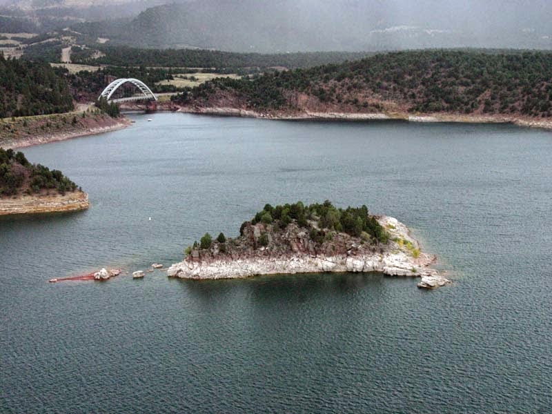
The Dam


View above the dam. Photo courtsey of the Utah Park Service


View of the Green River from Little Hole

Monday, May 4, 2015

Lovers Leap

Miles: 4.5 loop trail (Moderate)
Elevation Gain/Loss: 1,068 ft.

“This is the most beautiful place on Earth. There are many such places. Every man, every woman, carries in heart and mind the image of the ideal place, the right place, the one true home, known or unknown, actual or visionary.” --Edward Abbey

The clouds hang heavy in the sky like cotton balls soaked in oil.The air is cool and damp against my skin, and a slight breeze makes the tiny hairs of my arms stand at attention as if on the lookout for something unknown to me is about to happen. We step across the pavement and over a small wooden bridge. I am wrapped up in a lush blanket of green, and the river is rushing by me. With each step the smell of damp organic matter saturates my senses as it squishes beneath my feet. I am in the Appalachian mountains, walking along the Appalachian Trail. I am home.

To be more exact, I'm in Hot Springs, NC, walking alongside the French Broad River. We are climbing relentlessly upward as we make our way North on the AT toward the top of Lovers Leap Rock. I can feel the the effects of three weeks in a car. I move forward without stopping but my calves are burning and I'm moving slower the usual. Which means I'm moving pretty slow.

We reach the top of lovers leap after a mere 0.3 miles. From here there was a birds-eye view of the French Broad River, 500 ft. This iconic landmark gets its name from a Cherokee Indian legend that tells of a maiden who threw herself from the steep cliff after learning her lover had been killed by a jealous beau. Such a sad legend for such a romantic sounding place.


View of the French Broad River from the top of Lovers Leap Rock


From here we continued upward for nearly another two miles, discussing the recent catastrophic earthquake in Nepal, and the hypothetical future of Mt. Everest. Our hearts are with the victims families of everyone affected, and we are grateful for the safety of friends that have just made it home safely.

We took the Pump Gap Trail back down to the parking lot. The downhill was long but easy. As we neared the bottom we passed two small concrete buildings, which are old bunkers that were used to hold explosives.


There were also several water crossings and I managed to keep my feet dry until the very end. I regret not getting a picture, but the crossing was wide (maybe ten yards) but shallow. F** - it. I walked right on through. Shoes and socks will dry and my feet will eventually regain feeling.

Post trail refueling consisted of a salad, grilled chicken, and a beer from the local Spring Creek Tavern in "downtown" Hot Springs. While we enjoyed our meal on the outside porch we noticed the rather large group of thru-hikers gathered on the front porch of the Hiker Ridge Ministry across the way. "We should buy them beer when we go to the store" Cori suggested. Brilliant. We picked up a 24 pack of Yuengling on the way back from Dollar General and cheerfully delivered it to the very appreciative group of hikers...and bikers! That's right! There was a couple there that is currently biking the Trans America Trail, and they took a little detour to the south. The TransAm trail is something that Cori and I have talked about doing for the past four years. It was actually on our list to do before the PCT and it fell by the wayside when I went to work for The Nature Conservancy in Georgia in 2013. Tonight's encounter has definitely resurrected the interest and has it back to the top of our list once Cori gets her whole rib/heart thing under control. I'm also slightly terrified of road biking so some short trips will be needed before jumping I to a three month cross-country biking trip. Guess that means it's time to start planning a short bike trip! Highway 12 in Southern Utah sounds good to me ;) Stay tuned!

Fishing in Cherokee

May 3, 2013

I just dropped back to sleep when the alarm clock buzzed at 6 am. Uuggghhh. One if these nights I'll actually get some sleep. I pushed myself up, pulled on my long johns, and stuffed all my miscellaneous stuff back into my backpack. Cori and I were meeting Leeland on the river ( Cherokee/Raven Fork) in 15 minutes. It would be a long day. A very, very long day.

Today's Highlights
I saw a rainbow trout jump straight up out of the water like shamu. It was huge and it's belly shined the color of blood.

A heard of elk walked up to the rivers edge to say good morning to us. Leeland yelled at them to chase them off.

I practiced my casting. It was a hot mess.

I now have a pair waders to wear (thanks to Cori) so I wasn't to cold for too long.

Stone flys were emerging from the river and Leeland picked one up that had just floated to the top of the river. He handed it to me and I watched it has its wings finished uncurling and it took off to its next stage in life.

I watched Cori get taken for a swim by a horny head sucker fish. I wish I could have videoed it.

After lunch we drove to Portsmouth, OH to spend the night with Nutmeg, whom we haven't seen since Maine on the AT.

I neglected to take pictures of all the cool things I saw today. New goal: take at least one picture a day.

Thursday, April 23, 2015

Fly Fishing in Utah

Anyone who knows me, knows that fishing is not my favorite thing to do. It's kind of a time suck. I could be working, hiking/exercising, writing, reading. Essentially anything else other than fishing. Ever since Cori got into fly fishing last August she's been begging me to try it. Today, I agreed to go on a guided trip through Circle Valley Anglers. Admittedly I was kind of excited.

Our guide Lenny, took us to Mammoth Creek. The creek meandered along the backside of some private homes, down some dusty dirt roads in the middle of nowhere town Utah.The sun was shining, and the river was peaceful. It was a beautiful day.

Wednesday, April 22, 2015

Arches National Park: Delicate Arch

"A venturesome minority will always be eager to set off on their own, and no obstacles should be placed in their path; let them take risks, for godsake, let them get lost, sunburnt, stranded, drowned, eaten by bears, buried alive under avalanches - that is the right and privilege of any free American." --Edward Abbey

Delicate Arch
Miles: 3.2 (Moderate)
Elevation Gain: 670 ft.


Sunday, April 19, 2015

Bryce Canyon

My eyes popped open at 7:30am. I wanted so badly to sleep, but my internal clock was saying "haha! sucks for you!" I moved in slow motion, in a haze, stuck somewhere between sleep and a daydream. Cori was still asleep. I was full of jealousy. I can't remember the last time I slept through a night. I stumbled out of our musty motel room, and greeted by the cold morning air. It was 31 degrees in the high desert, blindingly bright and breathtakingly beautiful.

Saturday, April 18, 2015

Zion National Park

Angel's Landing
Miles: 5.4 (round trip - out and back)

Are we there yet? Breathe. Oh my God don't look down. Breathe. Sweet Jesus it's hot. Just breathe. Kids hike this?!? No Fing way. Just freaking breathe. Move forward; one step at a time. Oh thank God a traffic jam, we can stop for a minute. Breathe. Look at all those happy people coming back down; so relieved that the rock scramble is almost over. We're moving again. Breathe. Are we there yet?...

Friday, April 17, 2015

Death Valley National Park

After leaving Mono Lake we headed toward Death Valley National Park to camp for the night. We were somewhat on a time table that allowed us solely to enjoy the park by car. I was okay with this since (#1) it was getting late and (#2) the temperature outside was somewhere in the 80's and the thermostat got higher and higher the closer we got toward the park.

Thursday, April 16, 2015

Mono Lake

We left Shasta Trinity National Forest and headed back south. Under the advice of both friends and friendly strangers, we stopped by Mono Lake on our way to Utah. We weren't really sure what to expect but it kept being mentioned so we figured why not stop through.

The lake is located just to the east of Yosemite National Park, and serves as a major stop for migratory birds. Following our trend, we had gotten the there a few weeks before the huge influx of birds but there were still a few lingering out on the dry landscape.

Tuesday, April 14, 2015

Whiskeytown-Trinity-Shasta

I woke up this morning wanting to rip someone's face off. I needed to exercise. This sitting in a car thing is killing me, and unless I'm hiking 15 miles a day I'm not gonna keep the crazy away. Luckily, the hotel Siena Spa and Casino (Reno, NV) where we stayed last night had a gym, which had a treadmill. I jogged out the demons for about 30 minutes before heading to breakfast. I should be good for a few hours.

We've spent a lot of time focusing on logistics the past two days, but we finally have a new plan in place. We're heading back down South to National Park hop our way through Utah and across southern Colorado. But before we left the evergreen trees of beautiful Northern California we spent the night in Trinity-Shasta National Forest with the hope of getting some better views of Mt. Shasta. I say hope because a storm was rolling in, smothering Mt. Shasta in a swirl of grey and white.

Monday, April 13, 2015

Redding, CA

There is no National Park in Redding, CA, I know. We took a slight detour. We were actually on our way to Lassen Volcanic NP only to realize 1.5 hrs before our arrival that the main road through the park was closed and so were all the campgrounds. We've grown so accustomed to summer weather (by Boone standards) that we didn't really consider that winter, unfortunately, is still upon Northern California and the Pacific Northwest. Unfortunately this means no Crater Lake, Yellowstone, or Grand Tetons which is a little disappointing, however, it just means we need to stick to the southerly route on the way back to North Carolina.

Friday, April 10, 2015

Yosemite!

After taking refuge in Madera, CA to wait out a passing snowstorm we headed North to Yosemite National Park. The recent snow event caused some roads closure including Glacier Point where had planned to spend the afternoon so we headed into Yosemite Valley instead.

I'm overwhelmed by the amount of people here in Yosemite Valley. I can't even begin to imagine what it's like in the summer time. Even in early April, traffic is bumper to bumper. Short trails leading to popular attractions are nearly shoulder to shoulder. There are lines for a deli. There is a grocery store. Lodges. I understand these things exist in a National Park, but to experience the reality of it is a bit of a shocker. I feel like I'm in an amusement park.

Tuesday, April 7, 2015

Sequoia and Kings Canyon National Park

After rounding up some packages in the desert Cori and I headed North, but not without stopping in the Mojave one last time to get my picture with a Joshua Tree. I'm not exactly sure what my fascination is with these odd looking trees, but I've always been intrigued by them. To me they look like alien palm trees, but in fact are the largest species in the Yucca family. They exist mostly in the Mojave Desert, the hottest desert in North America, and their pollination is solely reliant on the female pronuba moth that lays her eggs on the yucca seeds which then hatch and provide food for the larvae.


Our drive into Sequoia meandered through the western foothills of the Sierra Mountain range. Here, elevations below 5,000 feet are too dry to support much vegetation beyond grasses and shrubs. I was surprised by this, thinking that we were far enough north to be out of the desert. I guess I'm spoiled by the lush green vegetation of the Southern Appalachians. Still the tall grass rolling hills were a welcomed change of scenery.


It's so hard to believe that these grassy hills lead the way to some of the largest organisms in the world. Mind boggling really. This past year I read The Wild Trees_by Richard Preston, a novelistic style non-fiction book about the Redwood and Sequoia's of Northern California. An excellent read for anyone interested in the adventure and science of these trees. My mind kept regressing back to the books passages about the discovery of the groves, their magestic nature, and the thrill of discovering such a magnificent organism! And here I was, wiggling around in my seat like a two year who has to pee. I was just giddy with excitement. "Redwoods! We're going to see Redwoods!" I exclaimed. "No we're not", Cori replied, with a thin lined smirk rising across her face. "We're going to see Sequoias. Not the same thing. " Leave it to the plant physiologist to bring me back down to earth. She's correct though, although easily confused and often described interchangeably, they are in fact different species. One of the most notable differences is where they are found. Sequoia's are found on the western slopes of the Sierras between 4,000 - 8,000 feet. The Redwoods, on the other hand, are located along the Pacific Coast. There are also many other physical/biological differences that distinguish each species. You can read more about their differences on the National Park Service website if you're interested.

It was the end of Easter weekend as we pulled up to the park entrance. I was hoping to get a campsite in the Lodgepole campground to sleep near the trees, but the welcome sign noted that the site was full. Bummer. We quickly snagged a campsite at Buckeye instead which is in the foothills. More desert. Yay!!! (Please note the sarcasm). Honestly though, this worked to our advantage since the night temps would drop below freezing up at Lodgepole and we would be much warmer camping at 2,900 feet than at 6,500 feet. Thank you fate.


After securing a spot to camp we headed North along the Generals Highway, stopping to get a glimpse of Moro Rock and it's neighboring peaks.


The drive up to the Giant Forest was slam-on -the-breaks spectacular. Thank goodness for pull-offs.


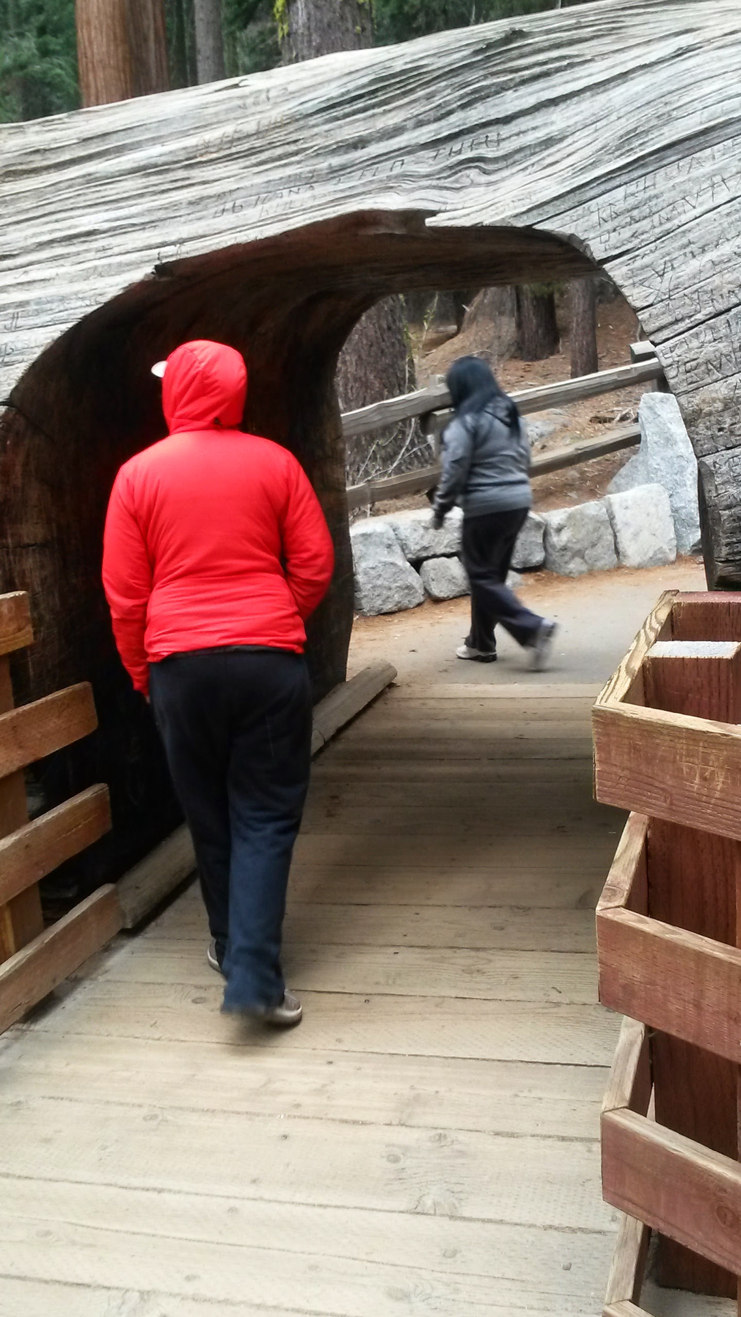
Sequoia National Park is the nation's second oldest National Park, and the first National park created to protect a single living organism. So it seemed fitting to make our first hike to see General Sherman, the largest (by volume) and one of the oldest trees on earth. General Sherman stands nearly 275 feet tall and is 106.5 feet across at its widest point. The tree is estimated to be between 2,300 - 2,700 years old.


The tree itself is fenced off for protection which was understandable but still slightly disappointing. Luckily there were plenty of other trees to admire up close and personal.


The second largest tree, General Grant is in Sequoia's neighboring park, Kings Canyon. The Grant Tree is the largest tree within the Grant Tree grove and is currently the second largest tree in the world. It stands 267.4 feet tall and measures 107.6 around its base.


A snow storm is moving into the region so we drove out of the park a day early and took refuge at a Quality Inn (Thank you Christine for the hook up!). Next stop, Yosemite!

Plan B: Western National Park Tour 2015

How do you grieve the death of a vision? I could dwell on what I "should" be doing (literally walking my ass off from Mexico to Canada). I could spend the next several days sobbing and being full of resentment as I make my way back to North Carolina. Or, I can look at my new found situation as an opportunity to see places that are on my bucket list. Why not? We paid to come all the way out here, and we're in no great hurry to go home. Bills are paid for the next five months and the dogs are being well taken care of. There seems to be no better time then the present.

I can't really take credit for this fantastic idea. I was pretty ready to be a sorrowful individual, but Cori came to me with the suggestion that we take this crappy situation of not hiking the PCT and try to take advantage of being out West to see some the world's most beautiful and historic places. It took awhile for the new plan to settle in, but when I could let go of my ego momentarily I had to admit that this new "Plan B" (as we've come to call it) actually sounded pretty awesome.

We came up with a short list of National Parks; Sequoia and Kings Canyon, Yosemite, Yellowstone, the Grand Tetons, and Rocky Mountains. Cori would rent a car and we would travel to each park spending a day or two in each one, and camp each night. If we wanted to stay somewhere longer or add places to the list we could always extend the rental car reservation. I know this means we just get to dabble in each of these places, but it still gives us the chance to see areas that we've never been to, and we get to experience them together.

Usually I use this blog to talk about my trail adventures, and driving across country doesn't really fit in with this theme. Still, I'd really love to share these places with our friends and family (the four of you that will read this) and I see no other valid reason to share it somewhere other then here.

So, over the next few weeks I'll share our adventures at each National Park as we make our way back East. Our first stop, Sequoia and Kings Canyon National Park.

Saturday, April 4, 2015

Day 2: What's Important in Life?

Lake Morena to Cibbets Campground
13.0 Miles

What's important in life? Is it how much money you make? How successful you become? The things you own? The experiences you have? The relationships you form? This question and all its potential answers have been funneling through my mind over the past two days. I'm sure for most, the answer to this question is some or all of these factors. Or maybe none of these at all.

I'm a very goal oriented person. I make up my mind to do something and I do it; at all expenses and sometimes regardless of the consequences (both positive and negative). I don't like to fail. So when we strolled into camp tonight and my partner looked at me and said she didn't think she could do this I blew her off. It took her breaking down into tears explaining in between sobs that her heart kept skipping beats and she had pain running through her chest for me to start looking beyond my own selfish goals.

Cori does have a heart condition, Wolf Parkinsons White syndome. Basically her heart has a tendency to race and/or have extra beats. She has a regular heart doctor that she sees annually who believed she would be okay out here despite the heat. She is active and healthy. She's ran marathons, played roller derby, and hiked the Appalachian Trail; all with no heart problems. On most accounts she is a healthy person. Still, the condition exists and she's had episodes in the past that caused her to modify her activity levels.

We knew this coming out here so we were careful to train and prepare ourselves to the best of our abilities. While hiking we've been extremely careful to stay hydrated and nourished. So when she first mentioned that she was in pain, that her chest hurt and she could feel her heart skipping beats which was making her uncomfortable I dismissed her. She needed to drink more water. She needed to realize that this was going to hurt. Thru-hiking hurts. We were going to be uncomfortable for a few weeks until we adjusted. She was fine. We hiked on. When we strolled into camp tonight she was in tears before she could even put her pack down. She hurt. Her heart was skipping beats and she was dizzy and nauseous. She couldn't do this. What do I say to that? OK, go home I'll see you in five months? You're being a hypochondriac drama queen. Get your shit together?

Cori and I have been together for almost six years. In that time I have seen her cry three times. Maybe. This was real. So at this point, what's important? The thought of leaving the PCT is devastating. And we just got started. But what are the consequences if I stick to my selfish goals and somehow convince her to stay with me? Daily sobbing episodes? Constant fights? Or something worse? Could she really have a heart attack? Is flirting with the line of dehydration for the next 700 miles really worth it?

No. It is not worth it. This wasn't some leg pain and sore shoulders. Tight calves and sore feet. Blisters. These things are to be expected. We were about to enter the Mojave Desert, the hottest desert in North America. We would have to hike 15-20 mile stretches in blazing heat daily just to replenish our water so we could keep ourselves hydrated.

I've come to believe that the relationships we form and the experiences we have with the ones we love are going to be what we cherish most in life. For that reason (and a few others) I am choosing to leave with Cori. Sending her home alone with no home to go to, and no job, and three dogs to pick up and take care of is not what a good partner does. I wouldn't want it done to me.

We are trying to make the best of a very devastating turn of events. We have rented a car and are making our way North. We plan on visiting Sequoia and Kings Canyon National Park, Yosemite National Park, Yellowstone National Park, and the Grand Tetons while we make our way home over the next two weeks.

The PCT will always be there. I'm sure we'll find our way out west sometime in the future.

P.S. I almost stepped on a rattle snake today and it scared the shit out of me.


Drying our stuff out in a lunch break